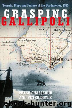
Grasping Gallipoli: Terrain, Maps and Failure at the Dardanelles, 1915 by Peter Chasseaud & Peter Doyle

Author:Peter Chasseaud & Peter Doyle [Chasseaud, Peter & Doyle, Peter]
Language: eng
Format: epub
Tags: History, Military, General, World War I, Europe
ISBN: 9780750963572
Google: CBSLBgAAQBAJ
Amazon: B00R0IOV3M
Publisher: Spellmount
Published: 2015-03-14T11:00:00+00:00
Turkish maps in Allied hands
A crucial – and unresolved – question is how long before the war large-scale maps of the Gallipoli Peninsula, the Dardanelles and the Asiatic Shore were surveyed, drawn and printed, and why copies were not acquired by the Allies? Given the rearming of some of the Straits’ forts and batteries with modern Krupp guns in the early 20th century, it is probable that at least a local coast defence survey was executed to tie together guns, range-finders, searchlights, etc., for fire control purposes. A further reason, and one closely related to the development of fortress plans directeurs, artillery maps, and trench maps before and during the First World War, was that the mobile howitzer batteries defending the Straits’ minefields were intended to fire ‘indirect’, i.e. to fire from defiladed positions, depending on survey for their line and range and on observation from a crest or flank for correction of fire. These batteries would have to shift position frequently to avoid being located and neutralised by air-directed naval gunfire (or by the fire of enemy artillery landed for the purpose), and depended on an accurate, large-scale map for determination of their position, the position of observation posts, and for target location.18
It is possible that a preliminary 1:25,000 ‘Southern Gallipoli’ sheet (part of the first 1:25,000 survey of western Gallipoli) was specially surveyed and printed at this stage as such an artillery map. Such a map of the Helles–Krithia area, unnamed and undated, was captured by the British after the first landings in April 1915.19 Another of the Helles–Kilid Bahr area, on sheetlines parallel to the graticule, was dated 1915 and allegedly used by Liman von Sanders.20 Such surveys and maps of strategically sensitive areas were, of course, subject to security restrictions, and would have been particularly difficult for Allied agents to acquire. There seems to be a prima facie case for arguing that the Allies should, before the war, have made greater efforts to obtain copies of these recent Turkish surveys, but the Turks had only just made, or were still making, their own new large-scale regular survey, and issued some of the new sheets only just before the Allied attack.
The Greeks may well have obtained copies of the Turkish large-scale sheets. Greek villagers and farmers would certainly have been aware of the work of the Turkish surveyors on the Peninsula and the Asiatic Shore. Lt-Colonel Cunninghame, military attaché in Athens from 1 March 1915, was shown the Greek operations maps by Colonel Metaxas on 3 March (he gave no details of scale, etc.), but told the Dardanelles Commission that the earlier absence of a British military attaché, and poor diplomacy by the British minister in Athens, Sir Francis Elliott, placed difficulties in the way of obtaining copies of these. When asked whether it would have been possible for the British military authorities to have had access to these maps, he replied that a good deal of suspicion had been generated by the very strong line which
Download
This site does not store any files on its server. We only index and link to content provided by other sites. Please contact the content providers to delete copyright contents if any and email us, we'll remove relevant links or contents immediately.
China Rich Girlfriend by Kwan Kevin(3900)
The Silk Roads by Peter Frankopan(3771)
Annapurna by Maurice Herzog(2845)
Hot Thai Kitchen by Pailin Chongchitnant(2815)
Full Circle by Michael Palin(2780)
Okonomiyaki: Japanese Comfort Food by Saito Yoshio(2391)
City of Djinns: a year in Delhi by William Dalrymple(2138)
The Ogre by Doug Scott(2118)
Photographic Guide to the Birds of Indonesia by Strange Morten;(2091)
Tokyo by Rob Goss(2022)
Vietnam, Cambodia, Laos & Northern Thailand by Lonely Planet(2016)
Tokyo Geek's Guide: Manga, Anime, Gaming, Cosplay, Toys, Idols & More - The Ultimate Guide to Japan's Otaku Culture by Simone Gianni(1949)
Discover China Travel Guide by Lonely Planet(1868)
Everest the Cruel Way by Joe Tasker(1829)
China (Lonely Planet, 11th Edition)(1799)
Lonely Planet China(1758)
China Travel Guide by Lonely Planet(1741)
Top 10 Dubai and Abu Dhabi by DK Travel(1718)
Iranian Rappers And Persian Porn by Maslin Jamie(1712)
